
Eco Energies

Why Buy an Agriculture Drone for Modern Farming?

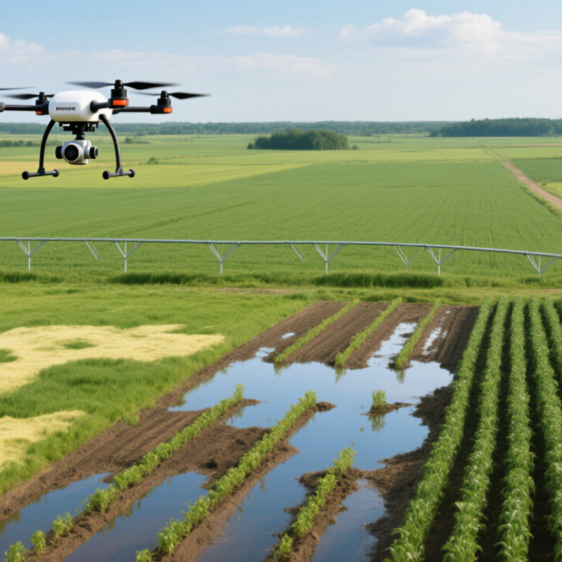
Modern farming faces tighter margins, unpredictable weather, and growing pressure to use resources wisely. An Agriculture Drone can give farmers a clearer view of crop conditions. From above, stressed plants may appear as uneven green patches. Aerial images can also reveal standing water, damaged rows, and missed planting areas. These details are difficult to notice while walking across hundreds of acres. They support more timely decisions about irrigation, scouting, and field maintenance.

The value becomes clearer during practical farm work. A drone can survey a large field before breakfast, even after heavy rain limits vehicle access. It may help agronomists compare crop growth across different soil zones. However, ownership is not automatically profitable. Not every farm needs one. Purchase costs, software subscriptions, maintenance, training, and data interpretation all deserve careful calculation. Weather can delay flights, and poor image quality can produce misleading conclusions. Reliable results require suitable sensors, consistent flight plans, and experienced review. Farmers should also follow local aviation, privacy, and agricultural requirements. A respected supplier should explain operating limits instead of promising perfect yields. This matters.

Choosing an Agriculture Drone should begin with a specific farming problem. Is the goal crop scouting, plant counting, irrigation assessment, or mapping? Clear objectives make equipment comparisons more practical. Independent field trials, transparent specifications, and support from qualified professionals can reduce costly mistakes. The technology is powerful, but it remains a decision-making tool. Good farming judgment still matters most.
Why Buy an Agriculture Drone for Modern Farming?

Agricultural Drones: Definition, Components, and Core Functions

An agricultural drone is an unmanned aircraft designed to collect field data or support crop management. Unlike ordinary cameras, it can carry specialized sensors above crops, soil, and irrigation areas. This aerial view reveals uneven growth, water stress, pest patterns, and damaged sections that may remain invisible from the ground.

Its main components include a lightweight frame, electric motors, propellers, batteries, navigation equipment, and a flight controller. A high-resolution camera records visible images, while multispectral sensors measure light responses from plants. Some models use thermal sensors to identify heat differences. A positioning system helps the drone follow planned routes and repeat surveys accurately. Ground software then converts images into maps that farmers can inspect.

Core functions include crop scouting, field mapping, plant counting, irrigation checks, and early problem detection. Spraying functions may also support precise application, but they require trained operators, safe weather conditions, and compliance with local rules. In practice, drones save walking time and produce useful records for comparing field changes. They do not replace agronomists or sound judgment. Wind can reduce image quality. Battery limits can interrupt a survey. Data may also be misunderstood without field inspection. That is the part many buyers underestimate. A careful farmer treats drone results as evidence, not absolute truth, and combines them with soil tests, crop knowledge, and direct observation.

How Drones Improve Crop Monitoring and Field Management

An agriculture drone turns a broad field into visible, manageable zones. From a low flight, its camera can reveal uneven emergence, standing water, and bare patches that ground walks may miss. Images captured over the same rows create a useful record of crop change. Small details matter. A pale strip near a field edge may indicate irrigation problems, soil variation, or simple camera glare.

For crop monitoring, repeated flights can produce maps showing plant density, canopy color, and areas of possible stress. Multispectral imaging may identify changes before they become obvious to the eye. However, these maps should guide inspection, not replace it. Walking to a flagged location helps confirm whether the cause is insects, disease, nutrient deficiency, or damaged roots. I have found that combining aerial images with soil notes and weather records produces more reliable decisions.

Drones also improve field management by helping teams prioritize scouting, adjust irrigation checks, and document storm damage. A manager can compare a troublesome zone after several days instead of relying on memory. Flight planning still requires care. Wind, low batteries, poor lighting, and dense foliage can reduce data quality. Operators need suitable training and must follow local aviation and privacy rules. The technology is powerful, but it is not perfectly objective. A dramatic color map can invite overreaction when the crop is actually recovering. Clear records, ground observations, and cautious interpretation keep decisions practical.

Why Buy an Agriculture Drone for Modern Farming?

How Drones Improve Crop Monitoring and Field Management

Drones equipped with multispectral cameras can measure the Normalized Difference Vegetation Index (NDVI), which ranges from -1 to 1. Higher values generally indicate denser, healthier vegetation, while lower values can reveal crop stress, poor emergence, water problems, disease, or nutrient deficiencies. This zone-based view helps farmers prioritize field inspections and apply treatments more precisely.

Key Advantages of Using Drones in Modern Farming

Why Buy an Agriculture Drone for Modern Farming?

Key Advantages of Using Drones in Modern Farming

Agriculture drones give farmers a faster view of crop conditions. A single flight can inspect uneven growth across several hectares. High-resolution images may reveal dry patches, standing water, pest damage, or missing plants. Thermal sensors can also show heat stress before leaves visibly wilt. This evidence helps farmers target irrigation, scouting, and field visits more carefully. In practical field work, accurate maps often save time and reduce unnecessary passes. However, drone data is not automatically reliable. Poor weather, weak lighting, or incorrect flight settings can distort results. One missed calibration may lead to a costly decision.

Tips: Fly during calm weather. Check battery levels and sensor settings before takeoff. Compare drone images with ground observations. Keep records. A qualified agronomist can help interpret unusual patterns. Follow local aviation and agricultural requirements.

The main advantage is better timing. Farmers can notice changes early, then respond before a small problem spreads. Drones also reduce exposure to muddy fields and allow safer inspections of large or difficult areas. Detailed maps support more precise planning for seed placement, irrigation, and crop monitoring. Still, technology has limits. A drone cannot understand soil history or every disease symptom alone. Small details matter. Combining aerial images with field notes, soil tests, and experienced judgment usually produces more dependable decisions.

Why Buy an Agriculture Drone for Modern Farming? - Key Advantages of Using Drones in Modern Farming
Data Dimension Typical Agriculture Drone Capability Practical Farming Advantage Operational Considerations
Crop Scouting Coverage Approximately 10–40 hectares per hour for many multirotor mapping missions, depending on altitude, image overlap, terrain, and battery changes. Large fields can be inspected more frequently than by walking every row, helping identify uneven emergence, irrigation problems, weed patches, and crop stress. Coverage varies significantly with mission design, field shape, wind, and image-processing requirements.
Image Detail Low-altitude RGB, multispectral, or thermal missions can commonly produce imagery with ground sampling distances of about 1–5 cm per pixel. Detailed imagery can reveal within-field variation that may be missed by satellite imagery or occasional visual inspections. Image quality depends on flight height, camera sensor, lighting, motion, and processing software.
Flight Endurance Many multirotor agriculture drones operate for roughly 15–40 minutes per battery, while fixed-wing systems may remain airborne for approximately 45–120 minutes. Short, repeatable missions support regular crop monitoring during key growth stages. Payload weight, temperature, wind, battery age, and safety reserves reduce usable flight time.
Variable-Rate Application Spraying systems can adjust application according to prescription maps, crop zones, detected stress, or target location. Inputs can be directed toward affected areas instead of treating an entire field uniformly, potentially improving application efficiency. A prescription map must be agronomically valid, and local pesticide labels and application rules must be followed.
Typical Spray Volume Many agricultural spraying operations use approximately 10–40 litres per hectare, although the correct rate depends on the product, crop, nozzle, target, and label. Lower carrier volumes can reduce water transport, refill frequency, and field-entry requirements in suitable applications. Lower volume does not automatically mean better performance; droplet size, coverage, drift control, and label requirements remain critical.
Field Traffic Flight-based monitoring and application can operate without driving a tractor or sprayer through the crop. Reduced wheel traffic can help protect standing crops, avoid some soil compaction, and improve access to wet or difficult-to-reach areas. Drones do not eliminate the need for ground equipment for many planting, harvesting, tillage, and bulk-input operations.
Timeliness of Treatment On-demand flights can be scheduled shortly after scouting identifies a localized problem, subject to weather and regulations. Faster response may reduce the time between detecting a pest, disease, or nutrient issue and taking corrective action. Treatment timing must still follow integrated pest-management principles and product restrictions.
Water and Terrain Access Airborne systems can reach slopes, soft soils, narrow plots, terraces, and crops that are difficult for heavy machinery to enter. Farm operations can continue in locations where ground equipment might cause damage or become stuck. Battery logistics, refill points, launch areas, and safe separation from people and obstacles are required.
Labor Efficiency Automated flight planning, repeatable routes, and digital mapping reduce some manual scouting and measurement tasks. Farm staff can spend less time walking large fields and more time validating findings and making management decisions. Human review remains necessary because imagery can produce false positives and does not replace field verification.
Data-Based Decisions Flight data can be converted into orthomosaics, elevation models, vegetation-index maps, plant counts, and thermal maps. Historical layers make it easier to compare crop development, identify recurring problem zones, and prioritize field visits. Consistent flight settings and good data management are needed for meaningful comparisons over time.
Weather Limitations Small drones are generally sensitive to strong wind, rain, poor visibility, and extreme temperatures; spraying performance is also affected by wind and humidity. When conditions are suitable, drones can provide a flexible alternative to waiting for large machinery or ideal soil traffic conditions. The aircraft manual, chemical label, aviation rules, and local weather guidance should determine operating limits.
Regulatory Requirements Commercial operations may require aircraft registration, pilot qualifications, operational approvals, maintenance records, and pesticide-application authorization. Compliance supports safer operations and reduces legal, environmental, and liability risks. Requirements differ by country, region, aircraft weight, airspace, and whether spraying is performed.
Best-Fit Farming Applications Crop scouting, stand counts, irrigation inspection, weed mapping, disease monitoring, spot spraying, orchard assessment, and drainage analysis. Drones are most valuable when decisions depend on frequent, location-specific information rather than one uniform treatment for the whole field. A clear operational goal and measurable return should be defined before purchasing equipment.

Note: Values are indicative ranges compiled from common agricultural drone operating practices and technical guidance. Actual performance depends on aircraft configuration, sensor and nozzle selection, field conditions, operator skill, crop type, and local regulations.

Choosing an Agricultural Drone for Different Farming Needs

Choosing an agricultural drone starts with the field, not the camera. A small vegetable plot may need precise imaging for uneven plant growth and pest damage. Broad grain fields usually demand longer flight time, stronger positioning, and efficient mapping. For orchards, obstacle avoidance matters because branches can hide weak signals and narrow flight paths. Measure twice.

Consider the task before choosing the payload. Multispectral cameras can reveal plant stress before leaves visibly change, while high-resolution RGB cameras support crop counting and surface inspection.

Spraying models require careful attention to tank size, droplet control, wind resistance, and local operating rules. More capacity is not always better.

A heavier drone may compact wet soil or become difficult to transport between distant fields.

In practical field trials, battery performance often differs from advertised estimates. Cold mornings, strong wind, and a full payload reduce flight time.

I once underestimated how quickly a muddy access road could delay battery changes. That mistake affected the entire inspection schedule.

Reliable selection also includes operator training, spare batteries, weather planning, data security, and repair support. Ask whether the system produces usable reports, not merely attractive images. Farmers should test the drone over one familiar field before expanding operations, because real terrain exposes weaknesses that product specifications can miss.

Operational, Legal, and Financial Considerations Before Purchase

Why Buy an Agriculture Drone for Modern Farming?

An agriculture drone can improve field scouting, mapping, and targeted crop treatment. However, buying one requires more than comparing flight time and camera quality. Measure twice.

Operational planning should begin with your actual fields. Narrow boundaries, uneven terrain, wind, and wet soil can affect daily performance. A typical workflow includes charging batteries, planning routes, checking weather, collecting images, and reviewing data. Staff need practical training, not just a short demonstration. Spare batteries, maintenance tools, secure data storage, and software subscriptions also add workload. If one person manages every task, deployment may become slower than expected.

Legal requirements vary by country and region. Confirm pilot qualifications, aircraft registration, operating limits, and permission for restricted airspace before purchase. Privacy rules may apply when cameras capture neighboring properties or workers. Chemical application may require additional certification, approved products, buffer zones, and detailed records. Never assume a supplier’s guidance replaces official requirements. Ask the relevant aviation and agricultural authorities directly.

Financial decisions should include the full ownership cost. Calculate the aircraft, batteries, charging equipment, training, insurance, repairs, software, and future replacement costs. Then compare these expenses with hiring a licensed service provider. Estimate savings from earlier disease detection, reduced inputs, and fewer field visits. Be careful with optimistic yield projections. Real results depend on crop type, weather, operator skill, and data interpretation. A small pilot project on one field can expose weaknesses before a major investment.